
Day 1
Mexican border/Yuma, Az. to 10 miles south of Castle Dome Mtns. , paralleling SR 95 in Sonoran Desert. (22 miles approx.)
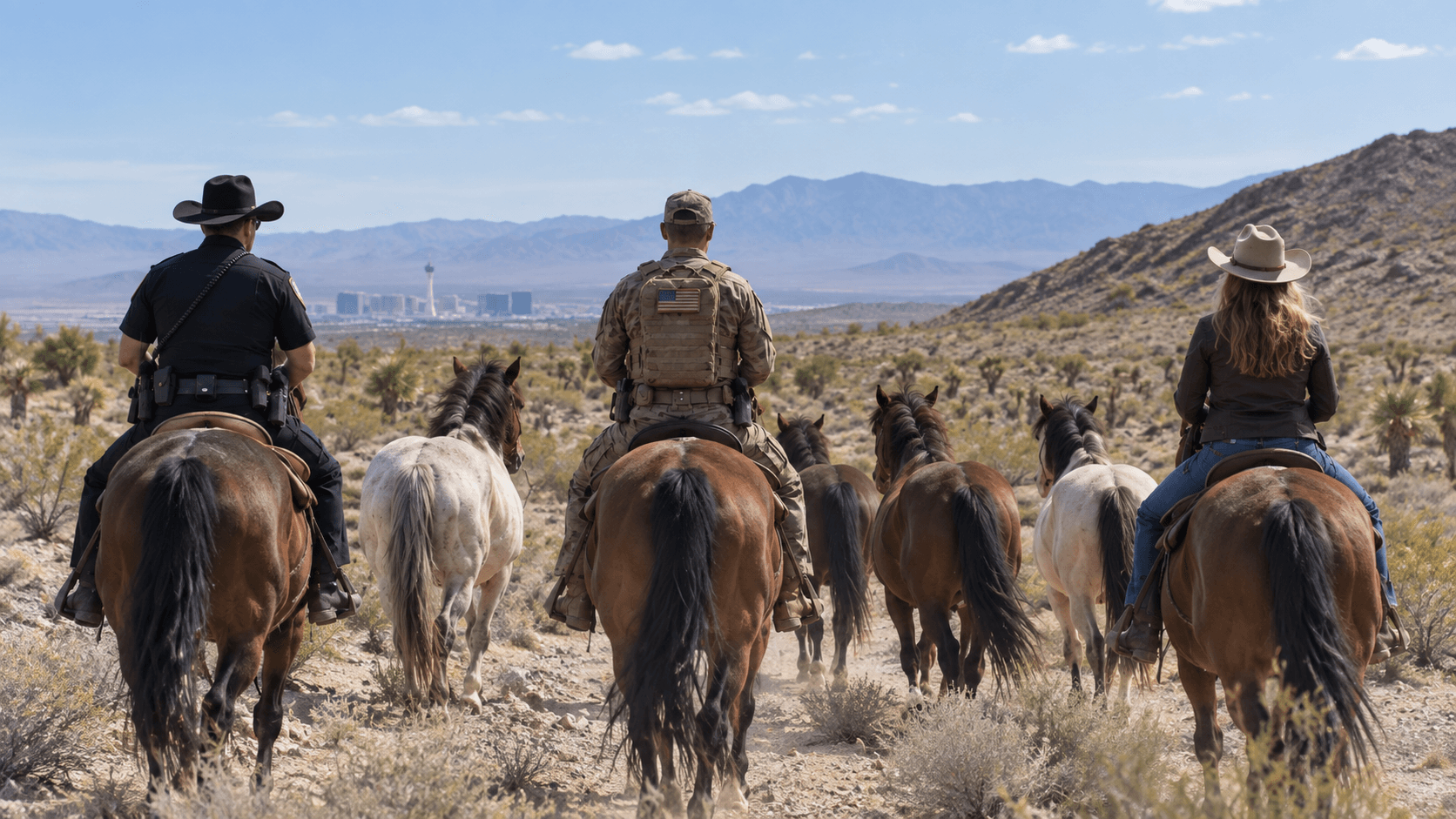
Ninety-nine days to the border, the rest days among them, and a party at the end — every mile below is the plan as written
Proposed route as planned on July 16, 2026 — subject to permits, weather, and the welfare of horses and riders.
Yuma to the Colorado River Indian Tribes
Mexican border/Yuma, Az. to 10 miles south of Castle Dome Mtns. , paralleling SR 95 in Sonoran Desert. (22 miles approx.)
Ride parallel to Castle Dome Mtns. to . (approximately 30 miles).central area of KOFA Wildlife Refuge. (approx. 22 miles).
KOFA Wildlife Refuge to eastern edge of Yuma Proving Grounds- (20-22 miles).
end day at Ehrenberg, Az., connecting with the Colorado River Indian Tribes. (20-22 miles).
Following Colorado Indian Tribes road, through reservation, camp along route to Poston, Az. (22 miles).
Rest Day
Parker to Jean, Nevada
Continue north to Parker through Poston. (20-22 miles).
Cross the Colorado River at Big River Rt. 62, camping along Colorado Aqueduct. (22 miles).
Turn north to State Route 95. through Mojave Desert toward Turtle Mtns. (22 miles).
Continue through Mojave Desert and connect with Ft. Mojave Tribe at the reservation, east of Needles, Ca. (22 miles).
Rest Day
continue towards Searchlight, NV. paralleling SR 95 (heading north, paralleling SR 95 through the Mojave Desert in Mojave National Preserve with the Sacramento Mountains, (54 miles).
Continue west through Searchlight, following Route 164/Nipton Rd. to Nipton, Ca., head north on Nipton Desert Rd., (22 miles).
Continue north on Nipton Desert Rd. towards Primm, NV, towards Old Las Vegas-Los Angeles Hwy. (20 miles).
From there continue north to the Old Las Vegas- Los Angeles Highway to Jean, Nevada (20 miles),
Goodsprings over Cottonwood Pass to Red Rock
turn northwest on route 161 to Goodsprings, Nevada (7 miles). Camp across road from Tom's place/Goodsprings.(7 miles).
Head north from Goodsprings on old dirt road, Cottonwood Valley Rd., through Cottonwood Pass to the Old Spanish Trail and route 160. Camp in Red Rock along Old Spanish Trail, approximately 28 miles.
Rest Day- Prepare for LV event.
Mount Charleston country to Bunkerville
Continue on Old Spanish Trail in Red Rock National Conservation area, taking a shortcut through the pass through the Madre Mountain Wilderness in the Mount Charleston area then cutting over to Las Vegas Paiute Indian reservation in the entrance to Desert Wildlife Wilderness area and Mormon Wells Rd. (26-29 miles).
follow Mormon Well Road crossing State Route 95 to approximate Pine Nut Rd. turn off, continue to Mormon Pass (approx. 6600 ft.) and camp for the night. (Approximately 28 miles first night, 2nd night 19 miles).
Exit Desert Wildlife Refuge to Pahranagat Wash crossing SR 93 to SR 168 paralleling wash. Continue for approximately 21 miles to Warm Springs Rd./ Moapa Valley National Wildlife Refuge. Camp there for the night. (21 miles).
Rest Day
Follow Rt. 168 to Muddy River Bar and Grill connecting to Powerline Rd. Approximately 3 miles to Old Spanish Trail, Follow to Riverside Rd./Rt. 170 to 5 miles south of Bunkerville, NV. (25 miles).
Littlefield, the Shivwits, Hurricane, Zion country
Bunkerville to Littlefield, Nevada (16 miles). Turn north on Old Highway, Highway 91/Old Spanish National Trail in Littlefield.
Littlefield, AZ to southern border of Paiute Indian Reservation. (22 Miles).
Continue north through Paiute Indian Reservation, at junction of Old Rt. 91/Rt.18/Rt.8, turn east/right at Shivwits towards Santa Clara 7.4 mi.) and Port of Entry (17.3 miles from Santa Clara(24.7 miles).
Port of Entry to Hurricane, Utah 36.4 miles. Follow Rt. 7 and look for jeep/horse trails near Sand Hollow State Park that skirt Hurricane on the east side to Rt. 59/Apple Valley.
Hurricane to Apple Valley/Rt.59 12.3 mi. Smithsonian Butte Rd./Scenic Backway to Grafton/Rockville. 7 mi. Total 20.3 mi. to Colorado City, AZ.
Rockville to Springdale-7 mi. Back track to Rockville to Big Plain Junction Rt.59, 14 mi., Big Plain Jct. to Colorado City 12 mi.- Total- 33mi
Rest Day
Moqui Cave to Fairview on the Old Spanish Trail
Colorado, City, Az. To Moqui Cave, Ut. Ponderosa Coral Pink Sand Dunes Scenic Rd. to Rt. 89 34.3 mi.
Rt. 89/Mt. Carmel Jct. to Long Valley Jct.- 20.6 mi.
Rt. 89 Long Valley Jct. to, Utah Bryce Jct. 40 mi.
Bryce Jct. to Panguitch-15mi. Panguitch to Bear Valley Jct. 10.1 mi-25.1 mi (7900ft.)
Bear Valley Jct./Rt. 89/Old Spanish Trail to Kingston, Ut. 23 mi.
Kingston, Utah to Marysville, Utah via rote 89/Old Spanish Trail -18 miles
Rest Day
Marysville, Utah to Elsinore, Utah, 22 miles following route old Highway 89/Old Spanish Trail.
Elsinore, Utah to Salina, Utah following the Old Spanish Trail/Rt. 89, 27 miles
Salina to Manti, 27 miles following SR 89
Manti, Utah to Fairview following SR 89, 28 miles
Rest Day
Scofield to the Uintas, 9,000 to 12,000 feet
Fairview to Scofield, Utah 27 miles via Route 31 to route 264/SR 96
Scofield, Utah to Colton, Utah via SR 96 18 miles
Coltan, Utah going south on SR 6 turning north on route 191 at Castle Gate/ Indian Canyon Scenic Byway (13 miles) to border of Uintah and Ouray Indian Reservation (approx. 25 miles).
Continue on SR 191 to just south of Duchesne, Ut. 26 miles
Head north on SR 87 head northwest on SR 35 to Tablona, UT- 25 miles
Stay north on SR 35 to Soapstone Mtn. then head northeast on Forest Service Rd 037/Basin Rd. connecting to SR 150. 32 miles
Prep for Wyoming
Stay on SR 150 to Evanston, Wy. travel through Uinta- Wasatch-Cache Range. 44 miles.
All mountains ranging from 9,000-12,000 ft. Will be remote but amazing part of the trip.
Project reaching Wyoming border on Day 57 with a big change in terrain as we cross into Wy. We will cross the Mormon Trail after approximately 15 miles south of Evanston, Wy.
Evanston to Bondurant on SR 189
Rest Day
Following SR 189 north, camp approximately 25 miles along the Little Muddy River.
follow SR 189 to Kemmerer, Wy.- approx. 25 miles
continue on SR 189, going halfway to LaBarge or approximately 24 miles
continue north on SR 189 to LaBarge- 24 miles
continue north on SR 189 through Big Piney, camping north of town a few miles.
continue north on SR 189 to Daniel, Wy. Camp near Daniel.
continue north on SR 189 to Bondurant- 29 miles
Rest Day
Jackson Hole over the pass into Idaho
Bondurant to Jackson, Wy.- approximately 26 miles
Jackson, Wy.- Victor, Id (stopping for breakfast in Wilson, Wy. at the base of Teton Pass). Approx- 24 miles
Victor, Id. to Felt. Id following SR 33- approximately 22 miles
Felt, Id. following SR 33 to Warm River, Id- approx.- 33 miles
Rest Day
(Teton Pass is known as Wyoming Highway 22. The pass is 4 miles out of Wilson, Wyoming sits at the base of Teton Pass. It is one of the most treacherous roads in the winter time anywhere in the US and is often closed due to avalanche and heavy snow. Teton Pass, connects Victor, Idaho, and Wilson, Wyoming. The pass reaches altitude of 8431 feet so temperatures vary every day of the year. It snows every month of the year somewhere in Teton Pass. At the state line of approximately 6690 feet, road becomes route 33 and continues to Victor, Id.).
The park leg, Henry's Lake, Island Park
The park leg's exact line is still to be set.
Prepare for Yellowstone Park leg-
Yellowstone Park- Route to be determined
Island Park, Id.- Henry's Lake, Id.-19 miles
Ennis to Montana City
Henrys Lake to Ennis, Mt is 54 miles (2 Days/camp somewhere along the Madison River).
Ennis, Mt. to Norris, Mt. . Follow SR 287 through Norris (stop at Norris Hot Springs), camp 4-6 miles north of Hot Springs along the Madison River- 20 miles.
Rest Day
north of Norris to Amsterdam, MT following SR 287-22 miles
Amsterdam, Mt. to Logan, Mt. 16 miles (Dinner at Land of Magic Steakhouse).
Logan/Tridente to Toston, Mt.- 29 miles
Toston, Mt. to Winston, Mt.- 24 miles
Winston, Mt. to Montana City, Mt.- 19 miles
Elliston, Ovando, Seeley Lake, Bigfork
Montana City to Elliston, Mt. going west on route 141-30 miles
continue on route 141 from Elliston to Nevada Lake- 25 miles
Rest Day
Nevada Lake, Mt. continuing northwest, on SR141, then pick up State Route 200 north to Ovando. Camp somewhere on SR 200 north of Ovando- 20 miles.
Continue next day to Seeley Lake, Mt. picking up SR 83 from State Route 200. Approx. 22 miles.
Seeley Lake to Condon, Mt.- 27 miles
Condon, Mt. to Swan Lake, Mt. 29 miles
Swan Lake, Mt. to Bigfork, Mt.- 14 miles
Rest Day
Seeley Lake, Montana to Bigfork, 79 miles(3 days)
Whitefish, Eureka, the border, and the party
on SR 82 on the north end of Flathead Lake, connect to Highway 93. Highway 93 to Whitefish, Mt.-34 miles
Whitefish, Mt. to Stryker, Mt.-30 miles 30 miles
Stryker, Mt. to Eureka, Mt.- 21 miles
Rest Day
FINAL DAY- EUREKA,MT.- CANADIAN BORDER-9 MILES
REST/PARTY LIKE THE OLD COWBOYS DID
Rest. Party like the old cowboys did
From the first mile in April to the Canadian border in August, the ride broadcasts daily from the trail.